Ops, algo deu errado!
Arquivos de mídia para Indivíduo 2960_Vicentini_2025_Santo-Antônio-do-Içá
Histórico
Arquivo de Image ligado à
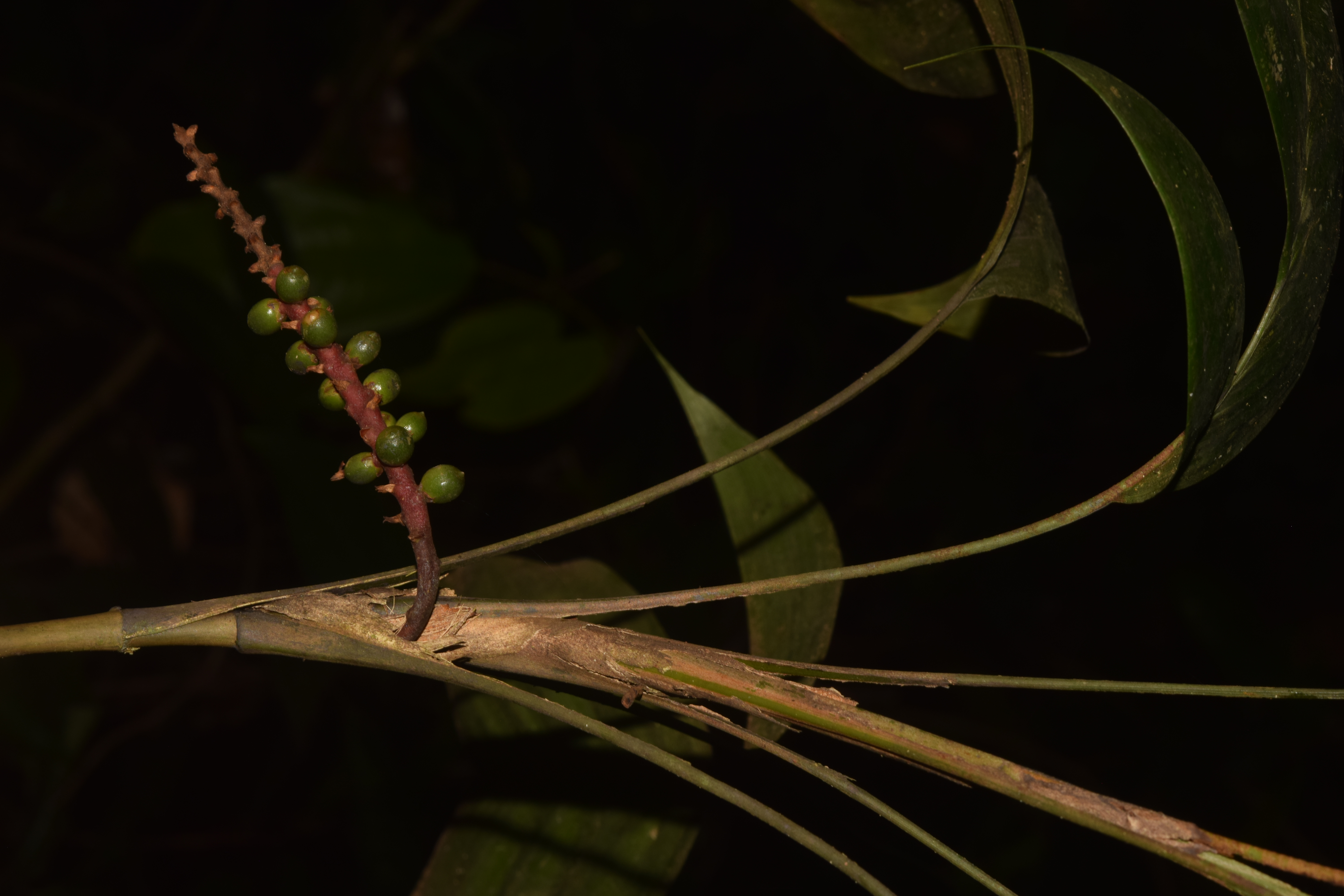
Indivíduo 2960_Vicentini_2025_Santo-Antônio-do-Içá
Licença
CC-BY-SA 4.0

Localidade
Brasil > Amazonas > Santo Antônio do Içá (Ponto)
POINT(-69.41139019726 -2.97675828202) decimal coordinates are POINT locations, ~ GPS precision; (POINT)
Bioma Amazônia | Amazonia
POINT(-69.41139019726 -2.97675828202) decimal coordinates are POINT locations, ~ GPS precision; (POINT)
Bioma Amazônia | Amazonia
Conjunto de Dados
Como citar
Geonoma (Arecaceae). (2025). By Alberto Vicentini and Charles Eugene Zartman and Marcos Ríos Paredes and Nigel Charles Andres Pitman. Collection: Vicentini, A. #2960 on 2025-05-06, from Santo Antônio do Içá, Amazonas, Brasil. Dataset: IR_Rio Iça_2025. Instituto Nacional de Pesquisas da Amazônia (INPA), Manaus, Amazonas, Brasil. Type: Image. License: CC-BY-SA 4.0. uuid: inpa-odb-f43b274d-5cd7-4a70-ae87-7f52b6f72364, url: https://opendb.inpa.gov.br
BibTeX
@misc{Vicentinietal_2025_42560,
{
    "title": " Geonoma (Arecaceae)",
    "year": "(2025)",
    "author": "Alberto Vicentini and Charles Eugene Zartman and Marcos Ríos Paredes and Nigel Charles Andres Pitman",
    "howpublished": "{https:\/\/opendb.inpa.gov.br\/media\/uuid\/f43b274d-5cd7-4a70-ae87-7f52b6f72364}",
    "license": "CC-BY-SA 4.0",
    "note": "Type: Image; Collection: Vicentini, A. #2960 on 2025-05-06, from Santo Antônio do Içá, Amazonas, Brasil; Coordinates: POINT(-69.41139019726 -2.97675828202); License: CC-BY-SA 4.0; Dataset: IR_Rio Iça_2025.; Accessed: 2026-05-31",
    "publisher": "Instituto Nacional de Pesquisas da Amazônia (INPA), Manaus, Amazonas, Brasil"
}
}